


Spatial objects are classfied into point object such as meteorological station, line object such as highway and area object such as agricultural land, which are represented geometrically by point, line and area respectively. For spatial analysis in GIS, only the geometry with the position, shape and size in a coordinate system is not enough but the topology is also required.
Topology refers to the relationships or connectivity between spatial objects.
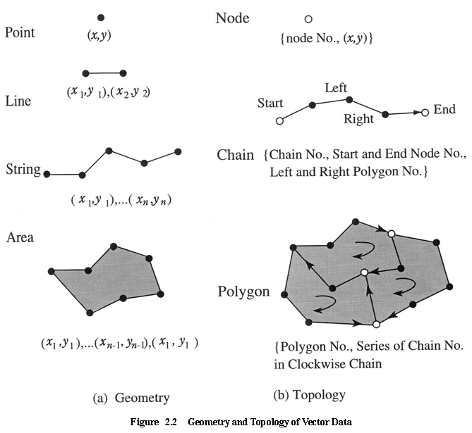
The geometry of a point is given by two dimensional coordinates (x, y), while line, string and area are given by a series of point coordinates, as shown in Figure 2.2 (a). The topology however defines additional structure as follows (see Figure 2.2 (b)).
Node : an intersect of more than two lines or strings, or start and end point of string with node number
Chain : a line or a string with chain number, start and end node number, left and right neighbored polygons
Polygon : an area with polygon number, series of chains that form the area in clockwise order (minus sign is assigned in case of anti-clockwise order).