


Imaging radar as shown in Table 4.1.1 is classified further into Real Aperture Radar (RAR) and Synthetic Aperture Radar (SAR). In this section RAR is explained.
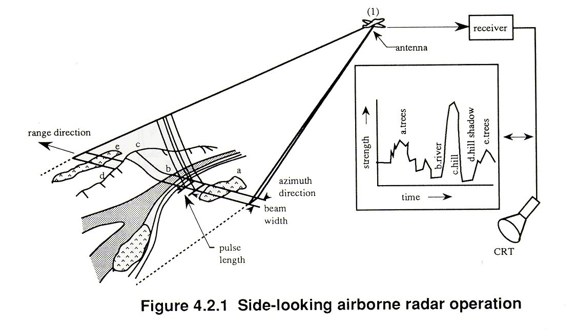
RAR transmits a narrow angle beam of pulse radio wave in the range direction at right angles to the flight direction (called the azimuth direction) and receives the backscattering from the targets which will be transformed to a radar image from the received signals, as shown in Figure 4.2.1.
Usually the reflected pulse will be arranged in the order of return time from the targets, which corresponds to the range direction scanning.
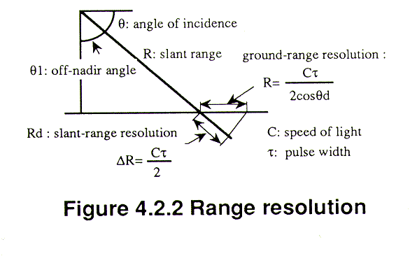
The resolution in the range direction depends on the pulse width, as shown in Figure 4.2.2. However if the pulse width is made small, in order to increase the resolution, the S/N ratio of the return pulse will decrease because the transmitted power also becomes low. Therefore, the transmitted pulse is modulated to chirp with a high power but wide band, which is received through a matched filter, with reverse function of transmission, to make the pulse width very narrow and high power as shown in Figure 4.2.3. This is called pulse compression or de-chirping. By making the pulse compression, with an increase of frequency f in transmission, the amplitude becomes  times bigger, and the pulse width becomes 1/TDf narrower. This method is sometime called range compression.
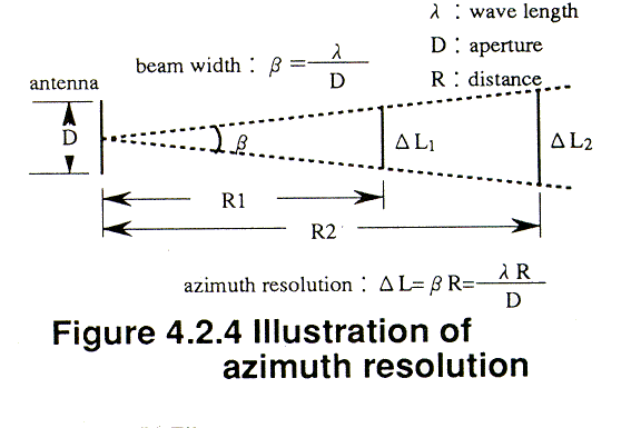
The resolution in the azimuth direction is identical to the multiplication of beam width and the distance to a target. As the resolution of azimuth direction increases with shorter wave length and bigger antenna size, a shorter wavelength and a bigger antenna is used for higher azimuth resolution, as shown in Figure 4.2.4.
However as it is difficult to attach such a large antenna, requiring for example a 1 km diameter antenna in order to obtain 25 meters resolution with L band ( =25 cm) and 100 km distance from a target, a real aperture radar therefore has a technical limitation for improving the azimuth resolution.
Copyright © 1996 Japan Association of Remote Sensing All rights reserved