


Multi-band image data are represented by a combination of spatial position (pixel number and line number) and band.
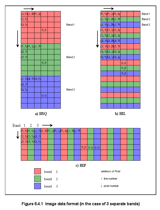
The data format for multi-band images is classified into the following three type, as shown in Figure 6.4.1.
a) BSQ format (band sequential) image data (pixel number and line number) of each band are separately arranged.
b) BIL format (band interleaved by line) line data are arranged in the order of band number and repeated with respect to line number.
c) BIP format (band interleaved by pixel) A set of multi-band data with respect to each pixel arranged spatially by pixel number and line number.
For color image output, BSQ format would be convenient because three bands will be assigned to R(red), G(green) and B(blue). However BIP format would be better for classification by a maximum likelihood classifier because multi-band data are required pixel by pixel for the multi-variable processing. BIL would be a compromise between BSQ and BIP.
Remote sensing data usually includes various annotation data in addition to image data. Since 1982, satellite image data have been provided in a standard format called World Standard Format, or LTWG format (specified by Landsat Technical Working Group).
The World Standard Format has the data structure called super structure with three records of volume descriptor, file pointer and file descriptor which describe the contents of the data (see 6.5).
Either BSQ or BIL format is chosen in the World Standard Format.
Copyright © 1996 Japan Association of Remote Sensing All rights reserved