


In order to achieve accurate geometric correction, ground control points with known coordinates are needed. The requirements of ground control points are that the point should be identical and recognizable both on the image and on the ground or map, and its image coordinates (pixel number and line number) and geographic coordinates (latitude, longitude and height), should be measurable.
Use of a topographic map is the easiest way to determine the position of ground control point. However maps are not always available, especially in developing countries. In such cases, control surveys had previously been required.
Today, however GPS (global positioning system) can provide geographic coordinates in a short time using a GPS receiver to measure time information from multiple navigation satellites.
GPS is a technique, used to determine the coordinates of a GPS receiver which receives radio signals from more than four navigation satellites. The received navigation message includes exact time and orbit elements which can be converted into the satellite position.
Two methods can be used for positioning; single point positioning and relative positioning.
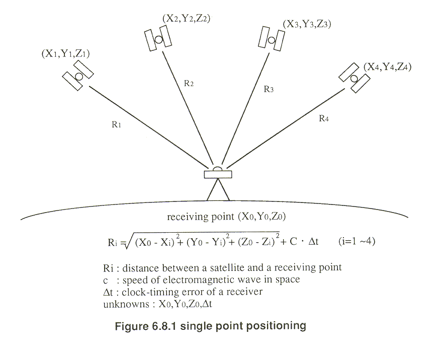
The single point positioning method determines the coordinates with the use of a single GPS receiver, as shown in Figure 6.8.1. The geodetic accuracy achieved is about 10-30 meters. The unknown variables are four; X0, Y0, Z0 and  t (clock-timing error of a receiver). Therefore at least four navigation satellites are necessary. GPS has 18 satellites in total, at an altitude of 20,000 km, with three satellites each in six different orbits, which enable any point on the earth to view at least four satellites.
The relative positioning method determines the relative relationship between a known point and an unknown point to the measured (see Figure 6.8.2). In this case, at least two GPS receivers should be located at the same time. The accuracy is 0.1-1 ppm of the base length between a known point and an unknown point. It is about 2-5 cm in planimetric accuracy and 20-30 cm in height accuracy.
Copyright © 1996 Japan Association of Remote Sensing All rights reserved