


A map projection is used project the rotated ellipse representing the earth's shape, to a two-dimensional plane. However there will remain some distortions because the curved surface of the earth cannot be projected precisely on to a plane.
There are three major map projection techniques; perspective projection, conical projection and cylindrical projection, which are used in remote sensing. There are described as follows.
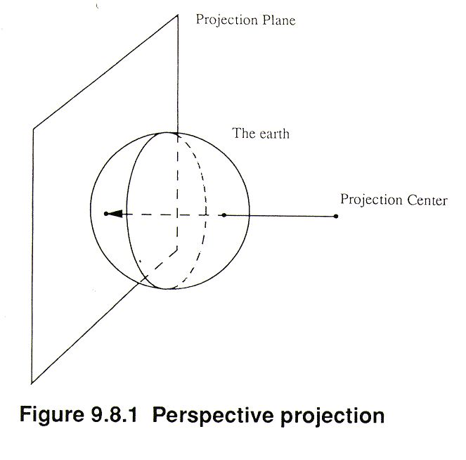
a. Perspective projection
The perspective projection projects the earth from a projection center to a plane as shown in Figure 9.8.1.
The Polar stereo projection is a perspective projection, as shown in Figure 9.8.2, which projects the northern or southern hemisphere from a projection center at the opposite pole to a vertical plane tangent at the pole. The NOAA Global Vegetation Index (GVI) data are edited in the polar stereo projection.
b. Conical projection
The conical projection projects the earth from the center of the earth to a conical body which envelops the earth. The Lambertian conical projection is a typical conical projection with the axis of the conical body identical to the axis of the earth. Aerial navigation charts are drawn using this projection for mid-latitudes, with wider areas from the west to the east.
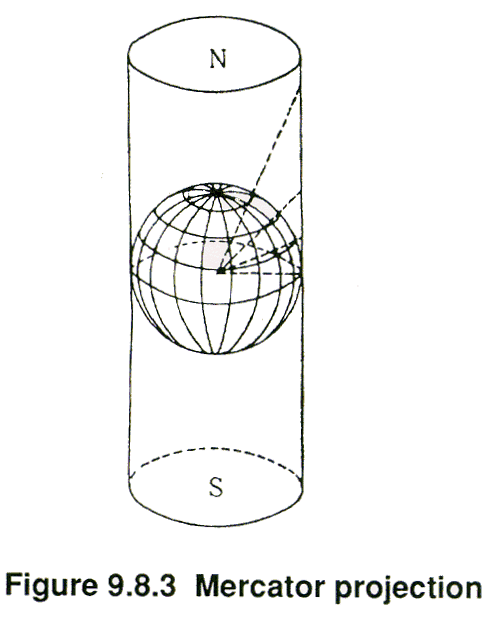
c. Cylindrical projection
The cylindrical projection projects the earth from the center of the earth to a cylinder which envelops or intersects the earth. The Mercator projection, as shown in Figure 9.8.3, is a typical cylindrical projection with the equator tangent to the cylinder.
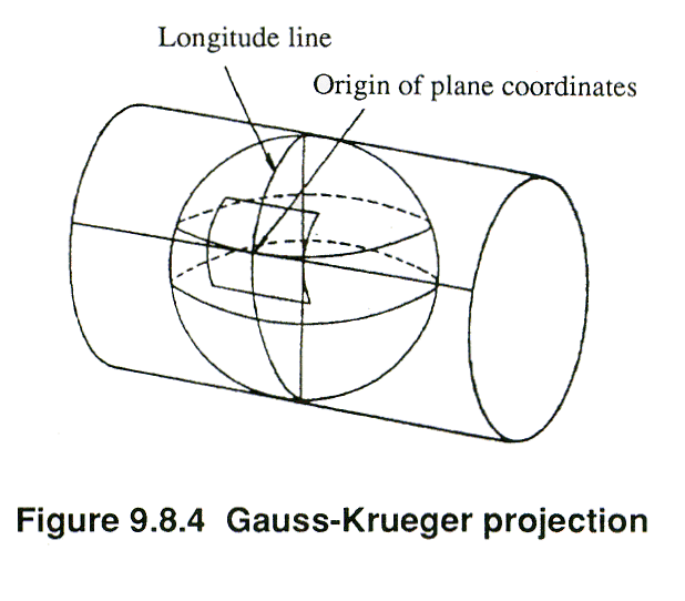
The Universal Transverse Mercator (UTM) is also an internationally popular map projection. UTM is a type of Gauss-Kruger projection, with the meridian tangent to the cylinder, as shown in Figure 9.8.4. The UTM has an origin point at every six degrees of longitude with a scale factor of 0.9996 at the origin and 1.0000 at a distance of 90 kilometers from the central meridian.
d. Other projections
For computer processing, a grid coordinate system with equal intervals of latitude and longitude, is often more convenient.
Copyright © 1996 Japan Association of Remote Sensing All rights reserved