


Image interpretation is defined as the extraction of qualitative and quantitative information in the form of a map, about the shape, location, structure, function, quality, condition, relationship of and between objects, etc. by using human knowledge or experience. As a narrow definition, " photo-interpretation " is sometimes used as a synonym of image interpretation.
Image interpretation in satellite remote sensing can be made using a single scene of a satellite image, while usually a pair of stereoscopic aerial photographs are used in photo-interpretation to provide stereoscopic vision using, for example, a mirror stereoscope. Such a single photo-interpretation is discriminated from stereo photo-interpretation (see 7.3).
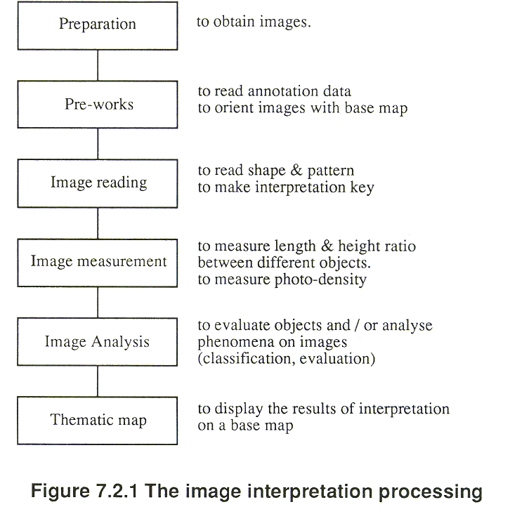
Figure 7.2.1 shows a typical flow of the image interpretation process.
Image reading is an elemental form of image interpretation. It corresponds to simple identification of objects using such elements as shape, size, pattern, tone, texture, color, shadow and other associated relationships. Image reading is usually implemented with interpretation keys with respect to each object, as explained in 7.4 and 7.5.
Image measurement is the extraction of physical quantities, such as length, location, height, density, temperature and so on, by using reference data or calibration data deductively or inductively.
Image analysis is the understanding of the relationship between interpreted information and the actual status or phenomenon, and to evaluate the situation.
Extracted information will be finally represented in a map form called an interpretation map or a thematic map.
Generally the accuracy of image interpretation is not adequate without some ground investigation. Ground investigations are necessary, first when the keys are established and then when the preliminary map is checked.
Copyright © 1996 Japan Association of Remote Sensing All rights reserved