Natural Resources Canada | Ressources naturelles CanadaGovernment of Canada | Gouvernement du Canada
FrançaisContact CCRSCCRS Site HelpSearch the CCRS WebsiteGovernment of Canada web site
Canada Centre for Remote SensingHome page of the Canada Centre for Remote SensingDetailed Listing of this SiteTechnical publications of CCRS staffExplanations of remote sensing terminology.Natural Resources Canada
Staff and organizationCCRS research programsImages and SensorsLearning aids and reference materialsThe Canadian remote sensing community

Table of Contents
1. Introduction
2. Sensors
3. Microwaves
4. Image Analysis
5. Applications

Home > LearningTutorials

Fundamentals of Remote Sensing


Chapter 5


5.6 Did You Know?

The sinking of a ship...

"...GPS = Good Protection Sidekick..."

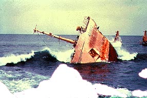
Accidents like the sinking of the Titanic are virtually eliminated now, with iceberg reconnaissance (provided by the International Ice Patrol) and GPS navigation onboard ships. And even if a ship did collide with an iceberg, search and rescue operations using remote sensing and GPS navigation could save many lives in such an incident.

Section 5.6 Section 5.6.1


Updated2002-08-21 go to top of page Important Notices