
| Table of Contents |
| 1. Introduction 2. Sensors 3. Microwaves 4. Image Analysis |
|
5. Applications |
Fundamentals of Remote Sensing
5.7 Land Cover & Land Use
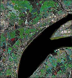
Although the terms land cover and land use are often used interchangeably, their actual meanings are quite distinct. Land cover refers to the surface cover on the ground, whether vegetation, urban infrastructure, water, bare soil or other. Identifying, delineating and mapping land cover is important for global monitoring studies, resource management, and planning activities. Identification of land cover establishes the baseline from which monitoring activities (change detection) can be performed, and provides the ground cover information for baseline thematic maps.
Land use refers to the purpose the land serves, for example, recreation, wildlife habitat, or agriculture. Land use applications involve both baseline mapping and subsequent monitoring, since timely information is required to know what current quantity of land is in what type of use and to identify the land use changes from year to year. This knowledge will help develop strategies to balance conservation, conflicting uses, and developmental pressures. Issues driving land use studies include the removal or disturbance of productive land, urban encroachment, and depletion of forests.
It is important to distinguish this difference between land cover and land use, and the information that can be ascertained from each. The properties measured with remote sensing techniques relate to land cover, from which land use can be inferred, particularly with ancillary data or a priori knowledge.
Land cover / use studies are multidisciplinary in nature, and thus the participants involved in such work are numerous and varied, ranging from international wildlife and conservation foundations, to government researchers, and forestry companies. Regional (in Canada, provincial) government agencies have an operational need for land cover inventory and land use monitoring, as it is within their mandate to manage the natural resources of their respective regions. In addition to facilitating sustainable management of the land, land cover and use information may be used for planning, monitoring, and evaluation of development, industrial activity, or reclamation. Detection of long term changes in land cover may reveal a response to a shift in local or regional climatic conditions, the basis of terrestrial global monitoring.
Ongoing negotiations of aboriginal land claims have generated a need for more stringent knowledge of land information in those areas, ranging from cartographic to thematic information.
Resource managers involved in parks, oil, timber, and mining companies, are concerned with both land use and land cover, as are local resource inventory or natural resource agencies. Changes in land cover will be examined by environmental monitoring researchers, conservation authorities, and departments of municipal affairs, with interests varying from tax assessment to reconnaissance vegetation mapping. Governments are also concerned with the general protection of national resources, and become involved in publicly sensitive activities involving land use conflicts.
Land use applications of remote sensing include the following:
- natural resource management
- wildlife habitat protection
- baseline mapping for GIS input
- urban expansion / encroachment
- routing and logistics planning for seismic / exploration / resource extraction activities
- damage delineation (tornadoes, flooding, volcanic, seismic, fire)
- legal boundaries for tax and property evaluation
- target detection - identification of landing strips, roads, clearings, bridges, land/water interface
![]()


![]()
| Updated2002-08-21 | Important Notices |