
| Table of Contents |
| 1. Introduction 2. Sensors 3. Microwaves 4. Image Analysis |
|
5. Applications |
Fundamentals of Remote Sensing
5.2 Agriculture
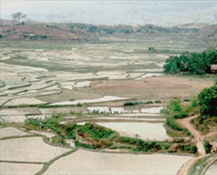
Agriculture plays a dominant role in economies of both developed and undeveloped countries. Whether agriculture represents a substantial trading industry for an economically strong country or simply sustenance for a hungry, overpopulated one, it plays a significant role in almost every nation. The production of food is important to everyone and producing food in a cost-effective manner is the goal of every farmer, large-scale farm manager and regional agricultural agency. A farmer needs to be informed to be efficient, and that includes having the knowledge and information products to forge a viable strategy for farming operations. These tools will help him understand the health of his crop, extent of infestation or stress damage, or potential yield and soil conditions. Commodity brokers are also very interested in how well farms are producing, as yield (both quantity and quality) estimates for all products control price and worldwide trading.
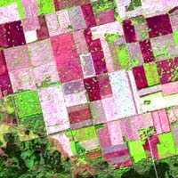 Satellite and airborne images are used as mapping tools to classify crops, examine their health and viability, and monitor farming practices. Agricultural applications of remote sensing include the following:
- crop type classification
- crop condition assessment
- crop yield estimation
- mapping of soil characteristics
- mapping of soil management practices
- compliance monitoring (farming practices)
![]()


![]()
| Updated2002-08-21 | Important Notices |