
| Table of Contents |
| 1. Introduction 2. Sensors 3. Microwaves 4. Image Analysis |
|
5. Applications |
Fundamentals of Remote Sensing
5.4 Geology
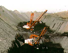
Geology involves the study of landforms, structures, and the subsurface, to understand physical processes creating and modifying the earth's crust. It is most commonly understood as the exploration and exploitation of mineral and hydrocarbon resources, generally to improve the conditions and standard of living in society. Petroleum provides gas and oil for vehicle transportation, aggregate and limestone quarrying (sand and gravel) provides ingredients for concrete for paving and construction, potash mines contribute to fertilizer, coal to energy production, precious metals and gems for jewelry, diamonds for drill bits, and copper, zinc and assorted minerals for a variety of uses. Geology also includes the study of potential hazards such as volcanoes, landslides, and earth quakes, and is thus a critical factor for geotechnical studies relating to construction and engineering. Geological studies are not limited to Earth - remote sensing has been used to examine the composition and structure of other planets and moons.
Remote sensing is used as a tool to extract information about the land surface structure, composition or subsurface, but is often combined with other data sources providing complementary measurements. Multispectral data can provide information on lithology or rock composition based on spectral reflectance. Radar provides an expression of surface topography and roughness, and thus is extremely valuable, especially when integrated with another data source to provide detailed relief.
Remote sensing is not limited to direct geology applications - it is also used to support logistics, such as route planning for access into a mining area, reclamation monitoring, and generating basemaps upon which geological data can be referenced or superimposed.
Geological applications of remote sensing include the following:
- surficial deposit / bedrock mapping
- lithological mapping
- structural mapping
- sand and gravel (aggregate) exploration/ exploitation
- mineral exploration
- hydrocarbon exploration
- environmental geology
- geobotany
- baseline infrastructure
- sedimentation mapping and monitoring
- event mapping and monitoring
- geo-hazard mapping
- planetary mapping
![]()
![]()
| Updated2002-08-21 | Important Notices |